I parked my car at the Sunset Point lookout. The plan was to hike down to the bottom of Bryce Amphitheater via the Navajo trail, continue on the Queens Garden trail, and return to the top at Sunrise Point. It would be a moderate hike of 2.9 miles. Before heading down the Navajo trail, I admired the view from Sunset Point.

The Navajo trail started out very steep, consisting of numerous switchbacks that led to a narrow mini slot canyon. I was amazed that trees managed to eke out an existence within.


The trail leveled off at the bottom, and I found myself among the trees and surrounded by hoodoos. Eventually, the Navajo trail met up with the Queens Garden trail. As I walked along, I heard faint drumming sounds, and noticed nuthatches flitting from tree to tree. It was hard to get a pic, they moved so much, but I managed to get one...it's a pygmy nuthatch to be exact.


I kept walking and a few steps later, an Uinta chipmunk ran across the path. This was soon followed by a well fed Golden Mantled Ground Squirrel. It kept begging for a handout...curse the people who gave it treats...but, I ignored it and it gave up and ran off. A couple of young women who said they were from Italy were fascinated with the chipmunk and were eagerly taking photos of it. They said they don't have chipmunks in Italy.


The Queens Garden trail gradually inclined, and I was soon walking among the hoodoos again. Eventually, the trail led to the Queens Garden itself. In the third photo below, you can see the rock formation known as Queen Victoria right of center. You can kind of imagine a queen wearing her cape and crown.


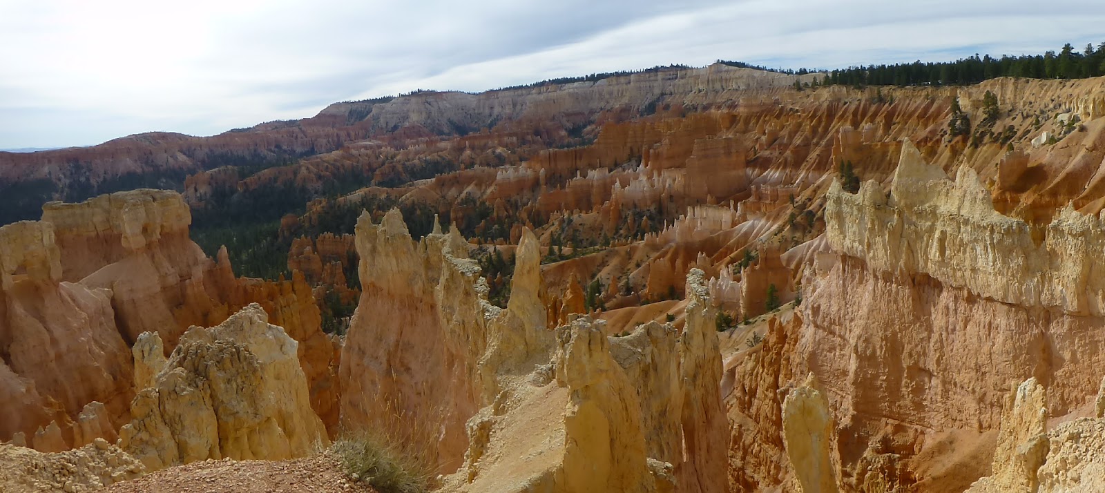
A mile more of hiking, and I reached the top at Sunrise Point. From there, the view of Bryce Amphitheater is gorgeous. In addition, you can also see Bristlecone Point, and to the right of that in the center of the photo, Sinking Ship.


Did you notice the interesting effect my camera's panorama feature has on moving people? Pretty cool, huh? After finishing my awesome hike, I ate my picnic lunch, then took the main park road all the way to the end at Rainbow Point. I took some photos, then headed back, stopping at most of the major viewpoints along the way. From Rainbow Point, Black Birch Canyon and Natural Bridge.


Even though the beauty of Bryce Amphitheater is pretty hard to top, I saved the best for last. You can't get any better than the views from Bryce Point and Inspiration Point. It was a fitting end to a wonderful day. And, it was also a great way to end my hiking adventures on this road trip!


Tomorrow, I continue to slowly make my way back home. I have a museum visit on the agenda...and perhaps a much needed car wash!
1 comment:
I used to make bumpy sand-castle/mountains at the lake that looked something like those, but I'm pretty sure these were made with a much different technique. ;-)
Post a Comment