Monday, October 2, 2017

Cedar Breaks: The Rampart Point Trail

I had a very nice stay in Hatch, UT last night. It was my second cabin accommodations of my road trip, and this one was almost as good as the last. I mean, check out the size of that television AND with Direct TV!


I had only one destination today... Cedar Breaks National Monument. I planned to tackle the four mile round trip Ramparts Point trail. It was rated as strenuous, and it wouldn't take long for me to find out why. My morning started out chilly...mid-30s...and foggy, with a brisk wind. Cedar Breaks has one large amphitheater of rock formations. Due to the low fog, it was partially obscured when I arrived.


I bundled up and headed out on the trail. The trail actually had a second viewpoint at the one mile mark...Spectra Point, I could see it in the distance as I walked.


There were many dead trees visible in the park...the result of spruce bark beetle infestation. There are also many bristlecone pines, which manage to survive in harsh terrain.


I noticed most of the visitors I encountered today only hiked to Spectra Point, which provides excellent views of the amphitheater.


As I continued on to Ramparts Point, I began to realize why the trail was supposed to be strenuous. The trail went downhill via switchbacks at first, then kept going down. I found myself thinking that I would have to hike back up later. As I walked, I noticed the trees had interesting features.


When I finally reached Ramparts Point, I thought is was just okay. I didn't think it was worth the tough hike ahead of me. After taking a breather and enjoying the absolute silence, I headed back.


Since I was in no rush, I took my time walking, and I found that I had to. It was pretty tiring! I did take photos along the way, which allowed me to rest. I kept my eye out for animals, and was rewarded when I sighted a least chipmunk and a female pine grosbeak.


Before I left the park, I checked out the Point Supreme Overlook right off the parking lot. As I walked to the viewpoint, I noted the sign which said 10,350 feet elevation! No wonder I was getting so tired hiking back up from Ramparts Point! I live basically at sea level, so higher elevation has an effect on me if I'm hiking. I didn't take many photos because I got much better views on my hike such as this one, which I snapped on my return trip.


Tomorrow, I have another hike lined up...a less strenuous one. My road trip is more than half over, and I'll be starting the slow trip back home.

Sunday, October 1, 2017

Picture perfect at Kodachrome Basin State Park

For the first time since I started my road trip, my alarm woke me up. Up till today, I had been waking up before my alarm. But, staying up till 12:30 am to watch my WSU Cougars football team beat USC, then waking up at 5:45 am to get to Arches National Park extra early meant I was tired last night. But, I was in no hurry this morning. I spent the morning driving the scenic route through Utah...Hwy 24 east, then south on Hwy 12. I stopped briefly at Capital Reef National Park to check out the petroglyphs just off the road. Why do the people always look like space aliens?


After turning onto Hwy 12, the winding road increased in elevation, and I stopped at viewpoints to admire the scenery. The fall colors were in full swing and made for a beautiful photo.


Continuing south, the highway passed through Grand Staircase-Escalante National Monument. I had always wanted to visit this park, and I wasn't disappointed with the impressive rocky vistas. At one overlook, I noticed a couple of Hopi chipmunks eating rabbitbrush flowers. So cute!


Of course, my day wouldn't be complete without a little hike. I had read that Kodachrome Basin State Park had excellent rock formations, so that was my destination this afternoon.


I asked the friendly ranger for the best trail, and he recommended the 1.5 mile Angel's Palace loop trail. It turned out to be an excellent recommendation because I took a lot of pictures!


Tomorrow, the plan is for another longer hike and more magnificent rock formations. I'm so glad the good weather is holding up...and my old knees, too.

Saturday, September 30, 2017

And then, the skies opened up...

I was up early this morning and left my hotel in Moab, UT by 6:45 am. I wanted to get to Arches National Park before it got busy. When I reached the Devil's Garden parking area, it was almost empty, which was no big surprise. By 7:30, I was walking the trail and feeling good.


My plan was to hike to Landscape Arch, Partition Arch and Navajo Arch, which would be roughly 2.6 miles in and back. I had done this hike six years ago, and decided it would make a nice, relaxing morning. Landscape Arch is the largest arch in the park, and precariously thin. No telling when it will finally succumb to nature's elements.


After climbing up the challenging slick rock, I took the side trail to the other two arches. As I did, the dark clouds to the north looked ominous. I had checked the weather forecast last night and it only said about an hour of rain around noon. I know I should have checked again this morning!


After checking out Partition and Navajo arches, I had been planning to eat an early lunch...I had brought food with me...but, as some raindrops fell, I changed my mind and decided to make my return.


Just before I got to the junction that would take me back to the parking lot, I stopped to snap pictures of a couple of mule deer feeding right next to the trail! They showed no fear of myself and a few other people who were there. Look at the ears on that young one!


There was an old couple I had run into earlier that decided to keep going to Double O Arch rather than cut their day short. I told them I wanted to get back before it REALLY started raining because wet slick rock is...well, slick. As I passed Landscape Arch again, the skies really looked angry.


I kept walking and it started to rain lightly. I quickened my pace, but about 500 yards from the parking lot...the skies opened up and it poured! I was only wearing a denim cover shirt and my sun hat, and I got pretty wet. I hope that old couple were okay...they seemed to be better prepared for weather than me. And, I wonder what the deer did when the heavy rain came down? Thankfully, since I was road tripping, I had dry clothes in my car. My T-shirt was only slightly damp, but the lower half of my pants was soaked.

As I ate my lunch in the car, the rain dissipated and the skies lightened. I changed into dry pants and put on my raincoat, then headed down the road to Skyline Arch. This arch once had a smaller opening, but in 1940 a huge section fell out, and the result is what you see today. I walked a short trail to the base of the arch, where you can see the broken pieces of the boulder.


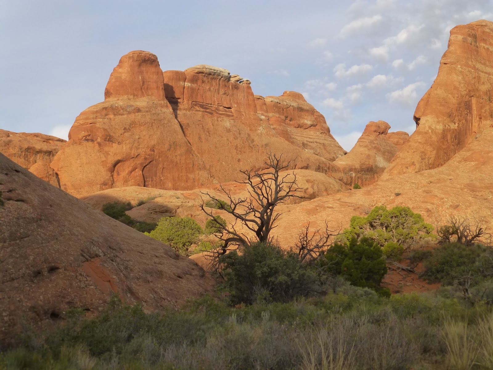
It was sprinkling lightly as I left Skyline Arch, but it was far worse elsewhere...we were surrounded by thunderstorms. I made two more stops before calling it a day...Double Arch and the La Sal Mountain viewpoint. The rock formation to the left of Double Arch is called Parade of Elephants. I have no idea if that "thing" in between has a name! At the viewpoint, I walked through potholes filled with rainwater and was treated to a spectacular vista amid sunny skies!


Kind of reminds me of Monument Valley. Before leaving the park, I purchased a new Interagency Annual Pass, which will get me into national parks for another year. It's a great value at only $80, and it pays for itself pretty quickly if you visit as many parks as I do. Tomorrow, I'll continue road tripping through Utah and seeing more natural sights. And, I'm pretty sure no rain for awhile.

Friday, September 29, 2017

Walking in Dinosaur Land

When I left my hotel in Vernal, UT this morning, I was expecting a nice, sunny day. There were a lot of clouds in the sky, but at least they weren't rain clouds. My destination of the day was Dinosaur National Monument, about a half hour east of town. I had visited this park on a previous road trip, but the Fossil Bone Quarry building and new visitor center were still being constructed.


I got to the park as soon as it opened and spent about a half hour in the Quarry Exhibit Hall looking over the dinosaur bones embedded in the rock. There are a number of dinosaurs represented here including the carnivorous Allosaurus and the Stegosaurus with its back plates and spiked tail. They had an Allosaurus skull on display and you can see a Stegosaurus skull in the rock.


After looking at the dinosaur bones, I decided to take in a hike. I chose the 1.5 mile Desert Voices Trail, which follows Cottonwood Wash before climbing out and looping around through desert terrain, then back down to the wash again. When I started my hike, it was still cloudy, but the sun broke through about midway. My photos look so much better when it's sunny!


As I walked along the trail, I snapped photos of things I saw along the way. Pretty furry lichens, purple Pacific asters, yellow rabbitbrush flowers and a desert cottontail hiding under a shrub.


Later, while I was eating lunch at the picnic area, a golden-mantled ground squirrel came over to look for a handout. There was none from me, so it sat on a rock next to my car to eyeball me.


I spent the afternoon driving through Colorado on my way to Moab, UT...my pit stop for the night. As I traveled south on Hwy 139, I stopped off the road at Douglas Pass to admire the view and the fall colors.


Tomorrow, I'll be spending the day at Arches National Park. I'll be revisiting some places I've seen before, but it just never gets old. This is one of my favorite parks and I'm looking forward to getting more nice pics!